Dalmatian National Parks by Boat and Bike 2 Sali to Trogir

Another lovely breakfast was followed by probably the hardest of the bike rides, along the length of Long Island (Dugi Otok).

Berthed at Sali

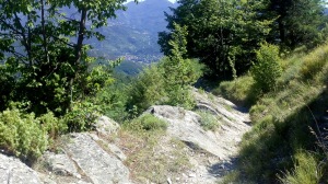
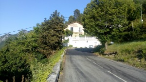
It was all along a very quiet road with a few demanding climbs, unless one had an ebike, and some spectacular coastal views.

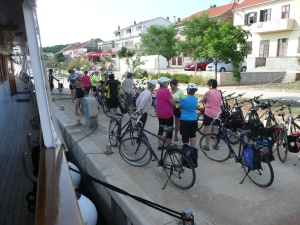
Getting ready to leave

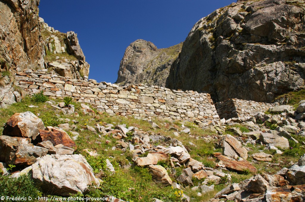
L decided to stay with the ship for this one. There were some glorious views over the sea and the islands.

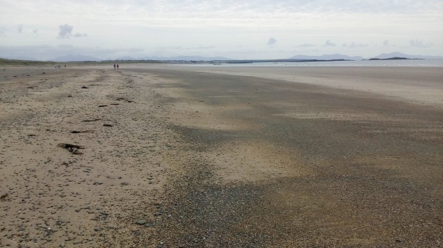
An early view back to Sali

There was a fish farm raising tuna, we were told.

Fish farm circles

There was a strong wind that was not entirely in our favour and I had a gear malfunction and ended the ride on our guide’s bike. I arrived with the advance guard and we had a 15 minute wait for the ship to arrive at the ferry port of Brbinj, a pretty desolate place with an expanse of tarmac and a hut or two.

Brbinj

Romantica arriving in Brbinj – note the choppy water

While we were there, the ferry boat arrived and we were amused to watch the anarchy of vehicles being loaded. There were a couple of people intermittently trying to direct traffic into lanes being totally ignored by drivers who just selected their own positions. We were due to travel on from Brbinj for a swim elsewhere but the strong wind lead to a change of plan and we swam from the ship at Brbinj instead.
There was a fabulous spread for the buffet lunch.During lunch we cruised to Zadar. Soon after we berthed, we were given an interesting guided tour of the historic old city and then left to our own devices for the evening. We took a small meal in a pleasant garden near the centre of the old town, then caught the sunset and the curious light show and sea organ, and returned to the ship in the dusk as a thunderstorm broke further inland.
Next day there was a short cruise to the island of Ugljan, just across from Zadar, where we docked at a small town called Preko

Preko harbour

and the bikes were unloaded for our ride across two islands to Tkon. This was quite a long ride but mostly flat and easy going.

The bridge joining Ugljan and Pasman

After crossing the bridge and joining the island of Pasman,

View from the Zdrelac Bridge of a boat that managed to get under it. Here is a link to one that did not https://www.youtube.com/watch?v=o695S2-VzS0

the group stopped for a break in the village of Zdrelac. L and I had consistently been back-markers so we asked to proceed on our own. We checked this out with our guides and set off on a quiet track alongside a more major but still pretty quiet main road. We passed a curious terrace of stone-built houses with domed basements that we thought could have been fishermen’s cottages. Eventually, the tarmac track became a stony path and we walked our bikes uphill about 15 metres to join the road. Arriving in Tkon we could see Romantica but it took us a while to find a way to get there.

When everyone arrived, bikes were rapidly loaded and we sailed off for Zlarin, an island and small village with a winter population of less than 300. It is in the province of Sibenik. There were strong winds on the way there and we were warned to take great care when moving about. Conditions for docking at Zlarin appeared challenging but the captain coped with aplomb, although he was shouted at by the harbour master with an electric scooter because a ferry was due and our ship was in its way. We rapidly disembarked for a walk around the small town while the captain sorted out the ship. There was a chance to swim from the beach but I declined on this occasion. The town was pretty but unexceptional, I thought.
After we had all returned to the ship we were off back to Rognizca, where there was good shelter from the wind. Another lovely dinner was served, followed by a stroll among the many holidaymakers busy buying things from the many stalls, and having pictures taken with among other things a group of colourful parrots. Over supper we were warned about an early start for the ship next morning, and we were off about 6.30 for the island of Solta, the closest island to Split.
We arrived at the pretty harbour of Mesalinic on Solta just after we had finished breakfast.

Very pretty and tidy harbour of Maslinica

Our bikes were unloaded and we started our round trip of about 15km to Grohote. We had a short time at a small, daily local market in the village. The vegetable stall was a picture and L quizzed the woman about her large melons.

The melons in question!

We then visited a bee expert at his “bee farm”. There we had an impassioned presentation on bees and beekeeping, tasted some bee products and visited a beehive and shop. On the return bike ride I was disappointed to see so much roadside litter but to counter that we also passed lots of olive trees and rosemary bushes, and the view on our descent to the harbour was exceptional. Our ship took us a short way to a sheltered spot for a swim from the stern deck; peaceful and crystalline blue sea, excellent and memorable. Then we left to return to Trogir, our starting point. Shortly after arrival we had a guided tour of the old town before our final dinner.
This was a very memorable trip with stunning scenery, excellent company and smooth organisation. But there were also many more mundane issues that stick in the mind like how to dry swimming gear and smalls outside our cabin doors and remembering to retrieve them during high winds. And the amusing antics of Zlatko, our waiter, and the line-fishing from the platform on the stern – all fish eaten for dinner later. And the food.

Posted in Overseas walking and tours | Leave a comment

Dalmatian National Parks by Boat and Bike 1: Trogir to Sali

Our trip was arranged through Rad+Reisen; an Austrian company we have been with many times before. The tour company, though, was German: Inselhupfen or Island-hopping. It started in Trogir and in order to meet our ship on time on Saturday 9th June we travelled to Trogir the day before. We flew from Gatwick to Split and took a local bus into Trogir. The bus station was just across a small, but busy, bridge to the picturesque old town. Our overnight apartment was through the old town and over another bridge – this one a drawbridge – onto Ciovo Island and up quite a steep hill.

Trogir old town from Ciovo bridge on right

It was very comfortable and good to get into an air-conditioned room. The weather was very hot and sticky. Later we had plenty of time to stroll around Trogir old town and take an early dinner in a ruined house with no roof. We had to move our table due to a shower of rain. That night there was a terrific thunder storm and there was still drizzly rain when I went out in the morning to fetch some breakfast.
On Saturday Trogir was crowded; tourist groups and shoppers thronging around the narrow streets with their polished stone paths. We took in the sites we had missed the previous day and had a stroll through the market. Then had a salad lunch with round “chips” at a quiet bar on the opposite side of the island from the harbour. We found our ship Romantica after lunch and went aboard to find our cabin about 2pm.

Our comfortable cabin with valued aircon

There was a group briefing at 2.45 when we heard all about the ship’s rules. While the briefing was underway so was the ship. We set off for our first stop at a small fishing village called Rogoznica. The storm of the previous night had an effect on the sea. It was quite rough and a few people suffered as a result. At Rogoznica we were able to walk along the coast to a small beach for a pleasant swim.
(While putting these notes into the computer, I did a bit of research and discovered this Freudian slip on the Rogoznica Tourist website – “Eager boaters are drown to one of the safest and loveliest ports on the Adriatic.” What a difference a vowel makes!)
That evening we had an enormous and tasty dinner on board. I felt guilty that such a lot had to be returned. After dinner we took a short stroll around the town.Next day was our first cycle trip. We cycled along the coast to Primosten where we met up with the ship again. It was not far, maybe 20km, with a steady climb out of Rogoznica and a steady descent into Primosten. During the ride there were excellent coastal views to be had including a distant view of our ship headed our way. The old town of Primosten was a delight. At one time in its past it was an island and the town walls are still impressive.

Approaching Primosten and gate in town walls

Inside the walls we had an opportunity to walk up to the church for more excellent coastal views.

Primosten Church on hilltop

After that we took our bikes back to the ship and many of us had a swim from its stern, in perfect blue water. After the swim and with everyone back on board the ship set off for our next destination, Sibenik.

During the voyage we engaged with a splendid lunch of tuna salad, sea bass and veg and cake; phew-again. At the entrance to Sibenik Harbour we passed the imposing Fortress of St Nicolas, a World Heritage Site. It was built by the Venetians in the 16th century to keep Turkish ships away from the harbour. At Sibenik the ship berthed while we had a guided tour of the town. It was very hot and we were glad of the shadows provided by the narrow streets. The tour finished at the Cathedral of St James, another listed World Heritage site dating from the 15th and 16th centuries. On our return to the ship we had another cruise up what now seemed like a river or fjord to Skradin, where we berthed for the night. We were taken to a konoba, a traditional bar-cum-cellar, where we sampled the local hooch and were instructed in the Croation history of such establishments. After, we were left to explore the town; there was no evening meal on the ship that evening. We walked to the Turina fortress which offered great views over the town. Skradin had quite a chequered history, being part of the Roman, Ottoman, Venetian, and French Empires under Napoleon, at various times.
Next day, after a glorious breakfast, we took an early start on a river boat for a visit to the Krka National Park. We were early but not quite early enough to miss all the crowds. However, by studiously ignoring the suggested route direction, we avoided the crowds and enjoyed this very special area. I have never been to such an atmospheric place. Perhaps it helped that there was a storm a few days previously, but the crystal clear water, abundant rivulets, bird song and thundering water falls created a lasting impression on me. It was also interesting to me that this was the site of the world’s second hydroelectric power station, opened in 1895 only 3 days after one at Niagara Falls. This station provided the power for street lights in Sibenik, the first city to be lit in this way.
Another boat trip back took us to Romantica and we set off again around 12.30. At the entrance to Sibenik harbour we had to wait for the traffic lights that control large boats through a narrow, deep channel leading to the Adriatic. The lights are controlled by the harbour authority and display permission by showing a green light. Once in the open sea again we headed for Vodice. Before arrival we stopped for a swim from the ship. Then, on arrival, we had an excellent lunch: mushroom soup followed by chicken in cream sauce with saffron rice.
At Vodice we had a short circular bike ride to the small island of Tribunj, which we rode around twice, marvelling at all the expensive yachts.

Then back to our ship for dinner: a starter of 3 cheeses, then salmon and, finally, pannacotta with fruit coulis. After, we needed the walk around the town’s sea front as the sun set. Despite the hour people, were out in force shopping, eating and drinking.

After a very adequate breakfast next day we set off on our bikes again, initially following the same route as the previous afternoon but continuing along the coast in a generally north westerly direction to rendezvous with Romantica at Slanica on the island of Murter. This was the longest ride so far of about 27km.

Rallying point before busier road down to Tisno

We mostly followed quiet roads into Tisno, where we crossed a bridge onto Murter Island.

Bridge to Murter Island

Just over the bridge, we had our first and only accident when one of our group tripped over a mooring rope and landed heavily hitting face and shoulder. It was nasty. The concrete shuddered, but she was able to soldier on. There was a short hill away from the bridge and then along a very quiet and picturesque beach road passing many camping and caravan parks and some quite isolated and expensive holiday homes. We arrived in Bentina with time to spare for coffee (but mostly ice cream) and other refreshments. It was then a very short ride to Slanica to rejoin our ship and for a swim prior to lunch. In the afternoon we had a cruise through many islands, many of which lie in the Kornati National Park. Our destination was the Telascica National Park and a walk to visit spectacular cliffs and an inland saltwater lake, called Silver Lake. The cruise was fantastic with blue, blue water and island upon island looking quite arrid, mostly apparently deserted, despite the presence of dry stone walls.

Romantica in the bay at Dugi Otok

Cliffs at Telascica

There followed a short cruise to Sali, where we spent the night. The evening meal was a special Captain’s dinner; wonderful food followed by music and dancing. A great end to a great day.

Posted in Overseas walking and tours | Leave a comment

Anglesey Coast Path 5 Cemaes to Holyhead

The first part of the next days walk was dominated by Wylfa Power station; no longer in use this station came into service in 1971 and finished at the end of 2015. A new nuclear station is now being constructed on an adjacent site. The land is lower here than the previous day, no huge cliffs but the feeling of remoteness continues.

Leaving Cemaes and back on the Coastal Path with Wylfa in the distance

Nearer the power station there are some delightful views in peaceful places.

Although in the process of decommissioning, the station remains a massive structure. It is necessary to skirt inland around the station and the extensive ground works underway associated with the new station, but the path soon rejoins the coast after passing an old water mill building.

Cafnan Mill

Cemlyn Bay is an attractive bay with a distinctive shingle embankment created during the storm that caused the Royal Charter disaster mentioned earlier. Behind this embankment is an RSPB Nature Reserve. We chatted with some of the volunteers who told us that the reserve is a special location for little terns that nest on the island in the lagoon behind the embankment. But last year otters appeared and just about destroyed the colony; what a dilemma. The RSPB are unsure how best to react. The embankment path is shut during the nesting season but we were able to walk across, it being September.

Soon after leaving Cemlyn Bay we met a birdwatcher nicely tucked behind a thick hedge giving him good shelter from a strong cold wind off the sea. He told us about the many seabirds he had seen that day. Shortly after a large group of Scandinavian hikers overtook us in ones and twos and strode ahead deviating from the path to visit Sant Rhwydrys Church, a church in the middle of a field slightly off the path. We gave it a miss but stopped soon after for a rest on a lonely beach.

Refreshment stop

The coast then became more rugged with corresponding more ups and downs. After a little while the Scandinavians started passing us again and by the time we stopped for some lunch it was just the back markers that had yet to reach us, The last two had gained a dog companion somewhere and were anxious to leave it with us but we demurred.

The curious white spikes we spied from way off are known as the Two White Ladies.

The Ladies were designed to align with the lighthouse on the island of West Mouse.

West Mouse island and Lighthouse (just about visible)

Further on we saw an attractive sea arch at Ynys y Fydlyn. The island is thought to have been an iron age hill fort.

Along the way we had a couple of good views of seals and the coastline was spectacular. Towards the end of the day it became less rugged and we left the Coast Path at Port Trwyn and went inland to catch a bus for our penultimate B&B.

Looking back over Porth Trwyn Bay where we had our last view of the Scandinavian party

We had a little wait for the bus followed by a break-neck drive with a driver obviously anxious to get home. Our lodgings were in a farmhouse with swallows still attending their nests. The landlady kindly gave us a lift to the pub that evening and a lift back to the Coast Path the next morning.

Another part of Porth Trwyn Bay

The final days walk was quite long but through much gentler terrain than the previous day. Most of the time Holyhead Mountain was encouragingly in view.  

There were some impressive bays before we reached the marshy land and long deviation round the Afon Alaw estuary. We finally crossed the river on the attractive green bridge only completed in 2012.

Approaching the Afon Alaw Footbridge which saves a few kms of walking

After crossing the bridge there is a longish walk down the other side of the estuary.

Just before reaching the village/town of Valley there is a walk along a beach and then into the houses and along a road. Somewhere along the road we lost waymarkers and thrashed about for a while before a kindly gentleman offered us directions, saying that new houses and owners were protesting about the path. We attempted to follow his directions but I think we probably failed and ended up walking along a quite unpleasant stretch of coastline that took us right to the Stanley Embankment crossing over to Holy Island and back to Holyhead.

At this point my companion was on her “last legs” and there was a dividing of the ways. I stayed with my companion and eventually caught a bus into Holyhead while D bravely carried on walking to fully complete the coastal path, possibly one instalment of an exercise to circumvent Wales on the Coast Path.

We met up at the B&B we stayed in the first night and treated ourselves to a celebratory meal that evening. Next day, on our way to the station we visited the Official starting point of the Coast Path.

The Anglesey Coast Path is, in my view, a fantastic walking route combining magnificent coastal views with interesting historical interest and heritage. I would encourage anybody to give it a go.

Posted in Walking in Britain | Leave a comment

Anglesey Coast Path 4 Moelfre to Cemaes

The path from Moelfre goes past the lifeboat station and a large sculpture of Dic Evans, a renowned local lifeboatman; he earned two RNLI gold medals for bravery, which is exceptionally rare.

Dic Evans statue and the lifeboat station at Moelfre

The path soon passes a monument to a tragic wreck of 1859 when the Royal Charter sunk and about 450 people lost their lives. This happened during a very severe storm that caused about 200 ship wrecks. The Royal Charter was returning from Australia with a large quantity of gold, some of which was washed up on the shore and reputedly made many local people very wealthy. Gold was still being found in the sea nearby as recently as 2012.

This is one of the least developed parts of the Coast Path but not without interest and beauty. The path follows a longish deviation inland to go round the large inlet of Dulas Bay.

Looking towards the sea from near the Pilot Boat Inn, our coffee stop of the day

From the road by the Inn we took the path over some marshy land, crossed over a small river and walked alongside the marsh on the far side of the bay before we climbed away from the water.  We stopped at Dulas Church and had our lunch while sheltering from the rain in the porch. Continuing on, we reached the coast again just opposite Dulas Island with its lighthouse-like rescue tower built in 1821, provisioned in times gone by as an emergency shelter for shipwrecked individuals.

Ynys Dulas

You can tell from the pictures that this was a rather gloomy day though the wildlife was quite special. We saw porpoises and peregrines as well as the usual suspect sea birds like turnstones and oystercatchers. However, during the afternoon the weather steadily worsened; so steadily that we did not put on all our waterproofs and by the end of the day we were very, very wet through, to underwear! The countryside was very attractive and this is a typical view showing our approach to Point Lynas lighthouse.

We were very pleased to reach our B&B/Hotel in Amlwch

Dinorben Arms Hotel Amlwch

for the night and more than grateful for the extra towels they provided. That evening we ate in the bar. It was local Bingo night and we were ushered out of the Bingo room.

It rained heavily in the night and was still at it next morning. So much so that we dawdled around in the hotel waiting for it to ease off. The hotel staff were very understanding and even gave us a free coffee while we waited. We finally left around 11 am. This was one of the shortest days, about 12 km, so the late start was not a problem. There was a short walk along a road before we rejoined the Coast Path and walked down to the cliffs and on to Bull Bay where we saw a kayaking group from Plas y Brenin setting out on a coastal row.

Approaching Bull Bay with kayakers

From this point we stayed on the cliffs looking down on some dramatic rock clefts, some of which the kayakers entered into and exchanged banter with us as we passed by. As we reached the point where we could clearly see the Porth Wen brickworks, the kayakers were paddling across towards it, possibly just visible in the picture.

Brickworks used to make bricks and floor tiles using quartzite from nearby quarries. It was closed after WW2 because access by sea was judged too dangerous.

Climbing away from Porth Wen we noticed the remains of a winding house associated with a tramroad used to deliver material to the works.There is a lot of industrial archeological interest on this stretch of coast. Amlwch was a centre of copper smelting, the copper being mined in the nearby Parys Mountain. There was a disused factory that extracted bromine from sea water close to the Coastal Path. The Porth Wen brickworks specialised in firebricks used in steel-making furnaces and a way further on from these works we found another factory; a china clay works, the Llanlleiana Ruins.

Before we reached that there was a dramatic stretch of coastline culminating in the view from  Llanlleiana Head, where an excited group were watching dolphins and gannets from an old lookout building that apparently boasted an underground wine cellar.

Llanlleiana Head from across Porth Cynfor with the island of Middle Mouse just in sight

From this point the view towards Cemaes, our destination for the day, was equally dramatic.

Lookout building just observable on headland

This was truly a beautiful piece of coastline. Here’s the view back towards Llanlleiana Head as we approached Llanbadrig Church

Llanbadrig Church is one of the oldest Christian sites in the UK; it was founded by St Patrick (Padrig) after he was shipwrecked nearby

and Cemaes.

Cemaes Bay

The beach at Cemaes has an interesting and novel wave-activated bell.

That night we ate at The Stag, the northenmost pub in Wales.


Posted in Walking in Britain | Leave a comment

Anglesey Coast Path 3 Beaumaris to Moelfre

Difficulties with accommodation forced a slight change in our schedule and instead of walking out of Beaumaris to our next stopping off point we took a bus out and walked back to have a second night at the B&B. Then, the following day took the bus again to the same point, the village of Llanddona, and walked onwards to another B&B. After we had found the correct place for the bus stop in Beaumaris, there was some ambiguity which we never satisfactorily resolved, the arrangement worked very well.

From the bus stop in Llanddona we walked down to the coast on Red Wharf Bay. On the way there were excellent views across the Bay with its extensive sand banks.

We were at the western end of the Bay and the beach there is mostly stony.

From here to Penmon Point the route is inland with several ups and downs. Our walk would have been easier if we had not selected a day when the “Ring o’Fire” annual coastal ultra-marathon was on this section of path. We were passed by many runners and walker/runners and often felt we had to give way to the competitors at stiles and narrow pathways. They were following a 3-day 135 mile course and this was the second day.

There are some good coastal views on the way and the path skirts the ancient site called Arthur’s Table (Bwrdd Arthur)

Penmon Point is quite spectacular with views of the lighthouse

Puffin Island and lighthouse at Penmon Point

We went down to have our lunch on the beach while the marathon runners took refreshments and hurried on their way to Beaumaris. While there we watched about 50 jetskis thunder past, presumably going round the coast. At any rate we did not see them returning.

Leaving the Point, the path follows a road and goes past the remains of Penmon Priory with its church and large dovecote. Between here and Beaumaris the path is either alongside the road or along the beach. Some of the beach is stony and walking is quite tiring. Guidebooks warn that some of the beach path is flooded in parts at high tide. The tide was low when we were there but we still found ourselves picking our way around very some soggy mudflats and we were still being passed by marathonistas splashing onwards. One of these looked completely bushed and her colleague, not a competitor, was stumbling along and offering encouragement.

It was a lovely afternoon and we had some great views across to the mainland.

Beaumaris had a food fair on that weekend and we could hear and smell our destination from far away.

Next day was wet just about all day. We were well prepared but it was still quite a drear day. After our bus journey we descended again to Red Wharf Bay and proceeded to walk in the opposite direction to the previous day, starting along the beach then the edge of a marsh

and then on top of a flood defence wall. At the end of the bay we crossed a bridge and walked along a frequently flooded track to reach the other end of the bay. Once there we could not resist the prospect of a warm, dry sit down and took advantage of the Ship Inn for some refreshment and to leave some large puddles on the floor (not that kind!).

We then passed through and around several caravan parks before descending to a beach and walking towards Benllech.

The path climbs round the headland after Benllech giving views back along the route. The drizzle continued and we were very lucky to find a rock overhang alongside a narrow path through shrubbery where we could have our lunch in relative comfort. A few walkers looked on with envy as we munched away muttering “Bon appetit” through clenched teeth as they passed.

After lunch we continued along the elevated path until we reached Traeth Bychan where the path descends to the beach through another small caravan park.

The beach of Traeth Bycan where we watched a family drive their car onto the beach and take surfboards into the waves after donning wetsuits!

Up and round the next headland we saw our pretty, small village of Moelfre.

One of the best views of the village, capturing its atmosphere, was available next morning as we were leaving.

Moelfre harbour and beach


Posted in Walking in Britain | Tagged , , | Leave a comment

Anglesey Coast Path 2 Aberffraw to Beaumaris

We started in the morning, soon after nine, by walking back into Aberffraw from our B&B, past the pub where we ate the previous evening, and down to cross the river. Then we followed a track crossing saltmarsh and sand dunes. Looking back there was a pleasant view of the river frontage of Aberffraw.

The track soon became a quiet inland road, which we followed, passing Borogan, which must be a grand house judging by the extent of the grounds and the gated entrances. After Borogan and just before Malltraeth we rejoined the waterside and walked along the edge of the Afon Cefni estuary with its very extensive sands. We were lucky to find a teashop in Malltraeth at just the right time for a coffee stop and some cake; it had just opened up the very moment we arrived. After refreshment we crossed the water on the dyke and continued on an elevated section down the opposite side of the estuary. We were soon walking through a pine forest, and finally emerged on the glorious beach of Newborough Sands. 

The tide was a fair way out so it was a dry walk to reach the small island of Yyns Llanddwyn.

The path out to the lighthouse, Twr Mawr, and Pilot Cottages

While some of my group walked out to visit the lighthouse I took the opportunity for a swim in the crystal clear water. The beach also offered good views of the Llyn Peninsula.

Leaving the island we walked along the beach reaching a crowded section near a car park where we left the beach and started walking through another stretch of pine wood. There followed a short section on a road which took us to a car park with a curious sculpture

Sculpture inspired apparently by marram grass

then off along a track and down to delightful stepping stones over the Afon Braint,

From there it was a short step to Dwyran and our B&B. This was one of the longest days about 25 km.

Next day was down to and along the Menai Straits. There was a thunderstorm in the night and heavy cloud remained. After traversing some country lanes and fields we emerged at the water, in a brief spell of sunshine, just opposite Caernarfon Castle.

After a brief spell of walking within metres of the water on the beach we joined a small road. We took a small detour off the road into a Farm shop and chocolatier to visit toilets and coffee bar then continued past the “Anglesey Salt Factory” and an old ferry station. At this point the Coast Path takes a large inland detour in order to circumnavigate Plas Newydd, a very large National Trust establishment. This is unfortunate in many ways but it did give us a chance to visit Llanedwen Church where we had lunch and had to don our rain gear. It also gave us an excuse to visit another interesting burial mound, Bryn Celli Ddu.

It is possible to enter into this tomb and look around although it was small and was rather crowded at that time, despite appearances in the photo. There followed a longish stretch of walking beside the busy A4080 road into Llanfair PG (more on this name later). The path is good but quite noisy and it was a bit of a relief to leave it behind and go back to the waterside.  We emerged at a small inlet/harbour.

Harbour where Afon Braint enters the sea, this is the river with the stepping stones

Just round the corner we had a magnificent view of Stephenson’s bridge and a statue of Lord Nelson.

The Britannia Bridge finished in 1850

We had a short walk, almost underneath the bridge up, to our B&B hotel for the night, which gloried in the full village name.

Next day was to be a shorter one, about 12 km, and we started one fewer in the group for E left us at this point and took the train home. We were headed for Beaumaris and a shorter day gave us the chance to spend some time looking round the castle there. The coast path went right past our B&B under the Britannia Bridge and down to the shore where the tide was in and the strong currents were visible on the water surface.

Looking across the straits from almost beneath Britannia Bridge

Within a short while the Menai Suspension Bridge was in view together with an ancient church and the Belgian Promenade. The bridge was designed by Thomas Telford and completed in 1826. Prior to this cattle had to be driven across the straits as cattle sales were the main source of income for Anglesey.

St Tysilio’s Church dating from the 15th century

The Belgian Promenade that extends from the church to the bridge was built by a group of Belgians accommodated in Menai Bridge during the first world war when their village was occupied by Germans. As an expression of gratitude they built the promenade; hence the name. Shortly after passing under the bridge we found a coffee shop with great views over the water.

Leaving Menai Bridge village the coast path follows the main road for a while. The path is good and not without interest

Afon Cadnant emerging into the straits opposite a series of small islands

but the road is quite busy. Soon after this bridge the coast path follows quieter roads away from the coast but with frequent views across to the mainland. We found a small shop in Llandegfan to buy some lunch and sat on a bench with a fabulous view across the straits to Bangor pier.

Lunch stop view Bangor pier at bottom right looking incorrectly as though it might start on this bank

A little over an hour later we arrived in Beaumaris, by which time the cloud had cleared and it was a lovely sunny afternoon. The views across the water were impressive.

We had ample time to visit the Castle

and still had time for a drink in the sun outside our hotel while a very good guitarist played for us. A great day ending in the best of all possible ways!

Posted in Walking in Britain | Tagged , , , , , | Leave a comment

Anglesey Coast Path 1 Holyhead to Aberffraw

A small group of us started this walk at Holyhead, arriving by train. The trip was organised by D with accommodation arranged in advance, so we had a schedule to keep to. The route is officially 200 km and D had allowed 12 days of walking. Our accommodation was all B&B.

On arrival at Holyhead we were not very impressed by the town; it seemed quite run down. But this impression improved when we left the station area and approached the sea front, enormous harbour and promenade on our way to our first B&B.

Next day, our first of the walk, took us to Trearddur. On the sea front at Holyhead we saw our first waymarks sunk into the pavement of the promenade. There are two varieties because the route at this point is both the Welsh Coast Path with a sea shell with a dragon tail symbol IMG_20170827_085101 (2)

and a tern symbol for the Anglesey Coast Path.

The path soon left the promenade and joined a track that took us past a grand old house, believed to be owned by the Harbour Master in former times and possibly the man in charge of the harbour construction. Soon we were in the Breakwater Country Park with  elegant entry gates.

In the background to this picture you can see some of Holyhead Mountain, the highest point on Anglesey, and the effect of quarrying for the stone that was used to build Holyhead harbour breakwater. The country park contains the remains of a brickworks which, we were told by a passing local, specialised in refractory bricks. Later on and higher up we had a good view back over the breakwater, snaking out into the sea. 

It is 2.7 km long, longest in UK, and accessible on foot. It was opened in 1873 after 28 years of work that employed around 1300 men and cost 40 lives (https://en.wikipedia.org/wiki/Holyhead_Breakwater).

The path passes close by an isolated building at North stack, a fog signalling station 

before climbing again. The path passes close to the top of Anglesey Mountain and it would only take a short detour to go to the top, though we selected not to take advantage. and carried across hillsides bright with blooming heather and gorse.

We reached the picturesque South Stack lighthouse around lunch time and found a picnic bench by the crowded RSPB cafe to take our lunch.

South Stack lighthouse

We visited Elin’s Tower before joining the road to continue our walk. Later we enjoyed great views back along the coast with clear views of lighthouse, tower and Holyhead Mountain.

The path continues mainly along the cliff top as the coastline meanders along with many pretty coves. At one of these, Porth Dafarch,

the path descends to a beach – very busy on this warm Bank Holiday Sunday – then climbs again away from the road and along the cliff top.  Fairly soon we were approaching Trearddur Bay 

Craig y mor – a reputedly haunted house

with a distinctive and rather threatening house on the shoreline.

Trearddur was the end of our first day’s walk and we repaired to our B&B for some rest and reflection. The paths had been well maintained and route-finding simple; it was lovely to see so many choughs and the scenery was spectacular. We had been walking for about 9 hours including stops and covered about 21 km. We felt we deserved our supper.

Next day, after a full cooked breakfast, we were off before 9. We had lighter packs because we were returning to our B&B that evening; this proved the easiest option with availability of accommodation. We planned to walk to Four mile bridge. The route started along the road out of Trearddur and soon joined a track heading for the coast while the road headed inland towards Four Mile Bridge, our destination for the day.

The walk started off as a coastal cliff walk that gradually decreased in altitude until we were walking along a beach and then a marsh to reach the bridge. There were good views behind, back to the start of the walk and our overnight resting place.

View back with white houses of Trearddur and Holyhead Mountain in the background

The coastline had more attractive coves and the odd cliff “door” arch.

Nearest village Rhoscolyn

After the cliffs we descended to beach level and walked past the holiday park in Port Wen bay.

It was quite windy and we were pleased to find some shelter near the beach at Sandy Bay. Using steps, we left the beach and walked through woods for quite a way inland before returning to the water on a marsh

and eventually almost wading to reach Four Mile Bridge.

The misleadingly named Four Mile Bridge joining Holy Island with the rest of Anglesey

We had a pleasant rest in a pub serving Leffe beer before our bus took us back to Trearddur for the night.

Next day another bus took us back to Four Mile Bridge for our walk to Aberffraw. The first part of the walk involved passing down the water on the opposite bank to that of the previous day.

Looking back to Four Mile Bridge

The path then passes close by Valley airfield, an active RAF base. Walking under the flight path was a bit unnerving. After that there is a long stretch along the beach parallel to the runway.

Heading to Rhosneigr past RAF Valley

After Rhosneigr, with a stop at a surf cafe, there are several more pretty beaches.

Beach at Porth Tyn Tywyn

Cutting across a headland the path passes a neolithic burial mound

Barclodiad y Gawres

Port Trecastell

followed by another pretty sandy bay. From here to Aberffraw, there were two notable features. The first, a rather surprising roar of motorcycles on a racing track. The second, a delightful church on an island, looking very isolated.

St Cywfan island church

We stayed overnight in the Prince Llewelyn, very comfortable.


Posted in Walking in Britain | Tagged , , , | Leave a comment

GR 52 – Fantastic Trek 4 Camp d’Argent to Menton

The Auberge L’Estive du Mercantour was welcoming and very practical for back packers.

For example, it was the only stopping place we found that offered a sink for washing clothes adjacent to a washing line. The manager was delightful, eager to help and knowledgable. Our dortoir had beds for 6 on 3 bunks and we shared the room with a French couple that we had met on the trail earlier that day. They were friendly and quiet. When we first arrived they were having an afternoon snooze in their bunks. The shower was more than excellent after two days without and after a clean up and a bit of rucksack sorting it was lovely to sit in the sun on the wide veranda and take in the sun and views, and a beer.

Dinner was good the main meal being plump round sausages cooked with lentils. We shared a dish with three Frenchmen, that I encountered later on. We had lunch time picnics from most of the previous Gites/Refuges, the ones from L’Estive were the most expensive at 8.50 Euros but also the most elaborate, a bulgar wheat salad with ham and cheese packed in a plastic box. It was a significant weight addition to our rucksacks. The breakfast was more than adequate and we were on our way by 8, as usual.

The route of the GR 52 has been changed in the last few years. An old TOPO guide I have, dated 2007, has the GR 52 avoiding Camp d’Argent and going direct from Pointe des Trois Communes to Sospel. In this guide it suggests that this takes nearly 9 hours of walking, and these are usually optimistic times; no allowance for stops. There is also nowhere to stop or stay on the route and only one unreliable water station. Quite an undertaking in other words. This new route is much more practical, but the stage to Sospel is still challenging about 23km long with a total descent of around 1700m, particularly in heat approaching 30C. On the strength of this analysis our dortoir French companions consulted the Auberge Manager and decided to walk some of the way then detour and bus for the remainder.

The new GR 52 track leaves the road about 100m down from L’Estive. It then more or less follows a contour across several hillsides; some tree-lined, others open sun-scorched meadow/scrub. Eventually we climbed and reached a trackway that seemed to join some ruined military buildings with the redoubt we had seen the previous day. There were relics of WWII here in the shape of an American tank.

Stuart M3 light tank outside the ruins of barracks at Cabanes Vieilles

We encountered this track again a short while later on in the day and decided to follow it for a while because it was a good walking surface and avoided a few climbs and descents. We rejoined the Official GR 52 route at la Baisse de Ventabren (1862m) where the path leaves the track on the left. Up to this point, for some little while the valley views were on our right.

View from track in the direction of Moulinet

after Baisse de Ventabren the views were on our left and we crossed a scorched hillside

with lovely views in the direction of Breil sur Roya.

We had a better view over Breil when we stopped for our lunch in some sparse shade at Baisse de la Dea.

Breil sur Roya from la Baisse de la Dea (1750m)

After this lunch stop we walked across more open country in blazing hot weather and reached a minor airy peak with a cairn.

Mont Mangiabo (1821m)

From here the route was almost all downhill with some of it very steep. Initially, we were in open grassland. Later there was some shade from tree cover. It was a quite grueling descent and we were very pleased to see the valley start appearing.

and then to see parts of the town of Sospel appear.

When we arrived in Sospel we were just about out of water and, after crossing the river, our first thought was to buy some water. But luckily we found a water fountain and drunk long from the cold water. (I forgot to take a picture but found this on a cycling website.)

We were rather disappointed to find that we had another climb to reach our overnight stop and were really relieved to get there, even though it was 7.15pm by that time and we had been walking, with stops, since 8am. The guide book indicates that this day’s walking is 6.5 hours. We were clearly walking slower, as we had found on previous days.

Auberge Provencale our overnight stop in Sospel

This was our most expensive overnight. We had a four bed unit with two single beds and a toilet shower on one floor and another two singles and shower toilet on an upper floor. We were in comparative luxury; no need to unpack our sleeping bags or our towels. I had only reserved beds but rather than face a walk back down into town to find something to eat we quickly changed that order to demi-pension. We ate that evening on the Auberge veranda overlooking Sospel and were comfortable in t-shirts until around 10pm when we retired.

The exertions of that day, and the prospect of similar weather, distance and descent on the morrow, caused my three companions to decide to take the bus to Menton. Despite the guidebook indicating 7 hours of walking I decided that the final day, with the walk to the sea was an opportunity not to be missed.

Breakfast was a little later than normal, 7.30 and I set off walking at about 9am. The others left later after a look around Sospel town, then took a bus to Menton.

The GR trail follows the road going past the Auberge out of Sospel and leaves the road at a hairpin bend. It then climbs steeply initially along a rocky path then a track and then lots of climbing with several false summits until I reached a col. This point is marked on the map as Ruines a la Albarea (635m), Sospel is at 350m. From there it was down slightly and across a hillside and, then a climb into woods with loads of sweet chestnut leaves on the path. These gave way to fir cones as the path climbed higher, reaching the Col du Razet.

Col du Razet (1032m)

During this climb I had been passing and re-passing a group of three Frenchmen we had first met two days previously. During one stop they admitted to me that they had lost their path and just decided to follow me. At this col there was a water trough which they all but bathed in and then consulted their maps and decided to go to Castellar instead of Menton. So a while later we went our different ways.

From the Col du Razet there were increasingly dramatic views of the coast. The next stage of the walk took me across a sun-blasted rocky hillside with thistles, rough grasses, lavender, lizards and hordes of butterflies. The path goes through an old border post of the Franco-Italian border.

Remains of border post

There was another climb up to a new col.

Col de Colle-Basse (1107m)

At this point there was evidence of sheep folds and the path followed a rocky track down and across the hillside with more sea views.

After the track, it was good to enter some shade in woods onto a footpath for a climb mostly in trees. This was followed by a steep descent with zig zags to the Prairie de Morga.

Morga (810m) on the IGN map it is called Mourga

There were some houses in this vicinity and one was offering water and seats under a shady awning for tired walkers; a lovely touch, though I did not stop. Nearby there were ruins where I took this picture of the coast.

The path went down at this point to around 810m to join a track/road which climbed up the far side of a hill. This picture is taken looking back.

The GR left the track and started a long climb firstly across scrubby land and finally, near the top under some trees, to the Col du Berceau (1090m). I stopped here for lunch and was joined by another group of three Frenchmen with whom I compared notes about the walk. It was very hot, even in the shade, but the view of the coast was breathtaking.

View into Menton from the last high point of the day. The path down is just visible at the right of the picture

The descent from this col was loose and rocky and walking poles were a very useful aid.

Looking back to the Col du Berceau from the path down

Eventually, I reached a more even and less steep part and reached the Plan du Lion (710m).

Looking back from the Plan du Lion to Col du Berceau

This was a welcome interlude until I realised I needed to climb a bit again. Fortunately, it was not far and then there was a long (about 90 minutes) descent across arid hillsides with sharp, charred tree trunks and dry grasses. Under the hot sun it was good to reach a road and sit down in the shade for a short while in earshot of the motorway on the outskirts of Menton.

About twenty minutes later, I met up with my trek companions and was enjoying an orange presse in a bar on the promenade. Shortly after I was having a swim in the Med. I had started at about 9 and finished about 4 so 7 hours in total, which was just about what the guidebook said. It just shows that one person walks much faster than a group.

We finished our visit to the South of France by spending another day in Menton and then two days in Nice. All in all a wonderful trek and a lovely experience.

Menton Looking back from Italian border

Posted in Overseas walking and tours | Tagged , , , , | Leave a comment

GR 52 – Fantastic Trek 2 Refuge La Madone de Fenestre to Refuge Nice

Refuge La Madone was very full that Friday night and there was a great deal of pressure on showers and toilet facilities. We were fortunate that our dortoir, with just 4 beds in line on a raised platform, was just opposite the shower/toilet; the only facility on that floor with at least three other dortoirs sharing. Neither the door on our dortoir nor the washroom would either shut or lock, but frankly this was a luxury that did not trouble us overly, the only exception being while I was showering and the door blew open. This was followed by several moments of confused, panicky activity. We arrived about 4.30 so after showering etc there was not much time before dinner. Dinner was another excellent meal which we took with a Parisian. His name was Aimen and he spoke faultless English.

Breakfast was the usual Refuge fare and very welcome. We ate around 7 and were on our way around 8am, having successfully found vacant toilets and wash basins. The weather was fine but the sun had not yet reached into the valley where we were walking. The refuge stood at the end of a road amongst a cluster of other buildings including a church, which I snatched a quick look around when I arrived.

La Madone de Fenestre Refuge (1903m) on left and church at right in background

Our destination for the day was St Grat, a hamlet of the Belvedere commune, following a recognised deviation from the GR 52 that avoids a high col. We also took it to avoid arriving at Refuge Nice on a Saturday, which I guessed would be very crowded.

The walk was a big climb to start with leading up to a very attractive high valley Vallon de Ponset.

Climb up from La Madone

Vallon de Ponset – peaceful valley with stream and small ponds

After a further climb we arrived at Baisse des Cinq Lacs and had a great view down to the lakes and across an expanse to the climb we were going to have to make to the Baisse de Prals.

A couple of the Cinq Lacs and in the distance the zig zags going up to the Baisse de Prals (circled) our high point later that day

The lakes were very attractive and we decided a good place to take an early-ish lunch. Curiously, we found a small pile of dragon fly wings on a rock as we were seeking a picnic place. Finding our way across to the climb we needed to make was a little tricky. We could see a high level belvedere track but our map and the track markers indicated we had to go down first. Reluctantly, we took the lower track which took us down and across quite a long way

The start of the climb

and eventually joined a path that is a listed GR 52 variant that climbs up to Baisse de Prals. It was a long climb made more demanding by high temperatures and growing humidity. The climb finished with sets of zig-zags. At the top there were great views back to where we had come from

Where we had come from in the direction of cinq lacs

Back down the hillside to where the paths joined

We then started a long descent of about 700m or more into the Vallon de la Gordolasque and the village of St Grat. There were lots of flowers on the way down but it was an unremitting descent and we were pleased to get to the road at the bottom and have a few hundred metres of road walking to stretch our legs a bit. However, by this time it had started to drizzle and we had donned waterproofs before we reached the Relais des Merveilles; a very welcome site. We arrived about 4.30.

Relais des Merveilles (1600m)

The accommodation was excellent, highly recommended. We had a dortoir with 6 bunk beds for the 4 of us and while we were told others might join us, nobody else arrived. The Relais was a hotel as well and the food was excellent. Dinner was melon with Parma ham and salad, blanquette de veau, cheese and isle flottante. The accommodation was very clean and just outside our dortoir was a large lounge with a woodburning stove and large screen TV. The stove was very welcome because it rained heavily in the evening and temperatures plunged. Breakfast was also of a much higher standard than we expected and the whole demi-pension was a bargain at 51 Euros per person.

As usual we had breakfast at 7 and were off around 8. It was not going to be a long day and we set off leisurely up the road to where it ended at a large car park/camp site which was already very busy and bursting its capacity. Cars were arriving and retracing their path to park by the side of the road.

The track followed an attractive, peaceful stream

Stream with many rock pools

Cascade de l’Estrech

and later a magnificent waterfall. We carried on climbing beyond the waterfall and had a rather glorious view back down the valley.Eventually, just before we reached a hanging valley, we walked through the Mur Des Italiens (Italian Wall), the remnants of an old border post between France and Italy. The border was moved at the end of WWII. This is what we were told by another walker but I have read on the Web that “According to oral tradition, this chicane was built of dry stones to protect the county of Nice from the Austrians.” Whatever, it came as a rather startling sight in an otherwise desolate landscape.

After entering the valley we crossed the stream we had followed all morning on a sturdy wooden bridge and started climbing again until we reached the barrage wall of Lac de la Fous. As we get closer I was astonished to see a group of three chamois walking on the almost vertical smooth concrete barrage wall, apparently licking the salts from the surface.

Passing the barrage wall there was a great view across the lake to Refuge Nice, our destination for that night.

Refuge Nice (2232m) in glorious isolation

We still had a walk around the lake, a tricky stream crossing beneath a magnificent waterfall, and then a short climb to the refuge but there was a coffee waiting for us and a chance to sit down and really take in the local views.

Posted in Overseas walking and tours | Tagged , , , | Leave a comment

GR 52 – Fantastic Trek 3 Refuge Nice to Camp d’Argent

Our sleeping arrangements in Refuge Nice comprised a small cubby hole with 4 beds on two bunks. The space between the bunks was too limited to accommodate any gear so all that had to be stowed in the open area beyond the cubby hole, which was part of a much larger dortoir with beds to the right and the left and above us. It sounds quite claustrophobic but in fact it worked quite well. It was busy and showers, that required a paid-for token for 3 minutes of hot water, and toilets were in much demand. The food was very good and the location and surroundings could not be beaten. Dinner was pea soup, veal, cheese and pudding. After dinner bouquetin came down to the area close to the refuge and during the day I saw marmottes, chamois, ravens, wheatear, dipper, pipettes and alpine choughs. There were also masses of attractive flowers.

We were up early for breakfast and ready for off at 8am. The day would involve two major climbs and two descents. It was the most remote and desolate region of the trek and included the Valley of Wonders (Vallee des Merveilles) a rugged area famous for petroglyphs (rock carvings) believed to date from the bronze age. The first stage involved an ascent from the refuge

The route up and away from Refuge Nice

essentially following a stream to a large lake, Lac Nire. After, there was a minor col before entering the Vallon du Mont Chamineye beneath the eponymous peak at 2921m. There were several snow patches (neves) in this valley and the next one and we often spied chamois playing or resting on the snow. There were a number of small lakes in this valley some with icebergs

The valley was followed by a steep and quite long climb up to the high point of the trek the Baisse du Basto 2693m. Looking back the valley appears quite desolate.

Looking back the way we walked up

The climb was just over 300m but it was very steep at the end and quite eroded and loose at the very top. This was signified on the IGN map by a red dotted trace, always a warning sign! From the top we could see our route forward down 300m or so and then up about 200m to la baisse de Valmasque (2549m) our final col for the day.

La baisse de Valmasque between the peaks in centre right

We passed more lakes with snow

and had to traverse quite a large snowfield before the ascent proper.

At the top I spied a chamois ambling past

and there were fantastic views behind

Lac Basto in the direction we had come from. The path up is on the extreme right and we came across the scree from the right hand side. The path on the rhs of the lake is not ours.

and in front into the Vallee des Merveilles.

Looking ahead into the Vallee des Merveilles

The descent into the valley was quite steep and stony but offered amazing views into what struck me as a very special and atmospheric place. We saw several marmottes as we walked through the rock strewn valley floor with large glacier-smoothed rocks everywhere.


The rock carvings in this valley and its surroundings were first described and studied in detail by a Brit at the end of the 19th Century.  In 1967 a Frenchman catalogued over 10,000 such carvings and now the whole area is very closely monitored and controlled  to protect these artefacts. Amongst other controls, visitors have to keep to defined paths and must not use walking poles with metal tips.

We were almost at the end of the valley when we met one of the site wardens who checked that we knew about the restrictions applied to the area. We confirmed we did and she offered one of us rubber tips for walking poles so they could be used. We asked about the carvings and she offered to show us a couple. I was surprised by how small and indistinct two if them were. I could easily have overlooked them. The other clutch known as The chief of the tribe” were larger but still rather underwhelming.

By Philippe Kurlapski – Private work, CC BY 2.5, https://commons.wikimedia.org/w/index.php?curid=792995

We thanked the warden warmly and walked on, later meeting her colleague who walked a while with us and retrieved the rubber pole cups. The day was hot and it was a relief to spy the lake

Le lac Long Superior with Refuge Merveilles on the right hand bank about 2/3rds down

and the refuge.

Refuge Merveilles (2130m) with lake behind

The refuge was not completely full but was crowded. We were put in a dortoir with 10 beds, 5 over 5, we were assigned the top bunks. But in the end only 8 beds were occupied. There was no hot water and the only shower near our dortoir had an appropriate warning notice attached. The evening meal was good but a little crowded. Breakfast was the standard fare and we were off, ready to walk, around 8am.

During this day the countryside became more gentle and we had our first convincing sight of the sea. We started by climbing to the lake that provided water to the Refuge. We first encountered the barrage wall

and walked past the lake above the barrage. We continued climbing passing more small lakes until we reached the Lacs du Diable

Lac du Diable with Pas du Trem in the background, the Pas du Diable was behind me

and beyond the Pas du Diable (2436m).

View ahead, into gentler country from Pas du Diable with the Med in the distance

This was a hot day, high twenties or even 30C I think, and it was a long walk to our next stop. The views were striking but a lot less dramatic than heretofore. In the more open countryside we struggled to find some shade for our lunch.

Approaching the Baisse de St Veran

After the climb on the side of the hill in the photo above we had the disappointment of a descent and another climb to reach the Col des Trois Communes.

Pointe des Trois Communes with the redoubt on the top of the hill 2080m

The view back down hill was a fabulous one with our track slowly disappearing into the mountains.

The redoubt was built in 1897 and was the first military building to use both stone and reinforced concrete, though the reinforced concrete was only used on the Italian facing walls. Around the area there were several remnants of military buildings including this barrack block we passed a little later.

The redoubt was the site of fierce fighting in April 1945 (http://www.cheminsdememoire.gouv.fr/en/redoubt-3-communes) and there is a memorial close by to the French forces involved.

There were another  2 or 3 kms to go before we reached our overnight stop around 4.30pm. The walk was mostly on tarmac down to a place called Camp d’Argent, no doubt a name derived from the old military ruins thereabouts. There were still impressive sights to gaze at.

View towards the Med

Our overnight stop was L’Estive (1737m) a very comfortable Gite just opposite a ski drag lift.


Posted in Overseas walking and tours | Tagged , , , , | Leave a comment